We continued to deal with “Bay Water” all week. The water temperature has remained very warm, ranging from 85.0 to 88.2 degrees. Catching has been painfully slow. Only two under size (less than 24 inches) King Mackerel were caught the entire 7 days. Lots of Hardtails, some Yellowtail Jacks and Ladyfish were caught. A couple of Bonita were caught two mornings. A few small Spanish Mackerel were decked almost every day and Monday we caught several undersize Pompano. Bait has been available but not plentiful. There were small Hardtails with a few Cigar minnows and Alewives in the mix.
Anglers had to work hard but a few Spanish Mackerel were caught daily. Most were small but a few might have been 18 inches. You had to invest a lot of time and a high number of casts to get enough for a meal. Kim cast for over three hours but finally caught one.
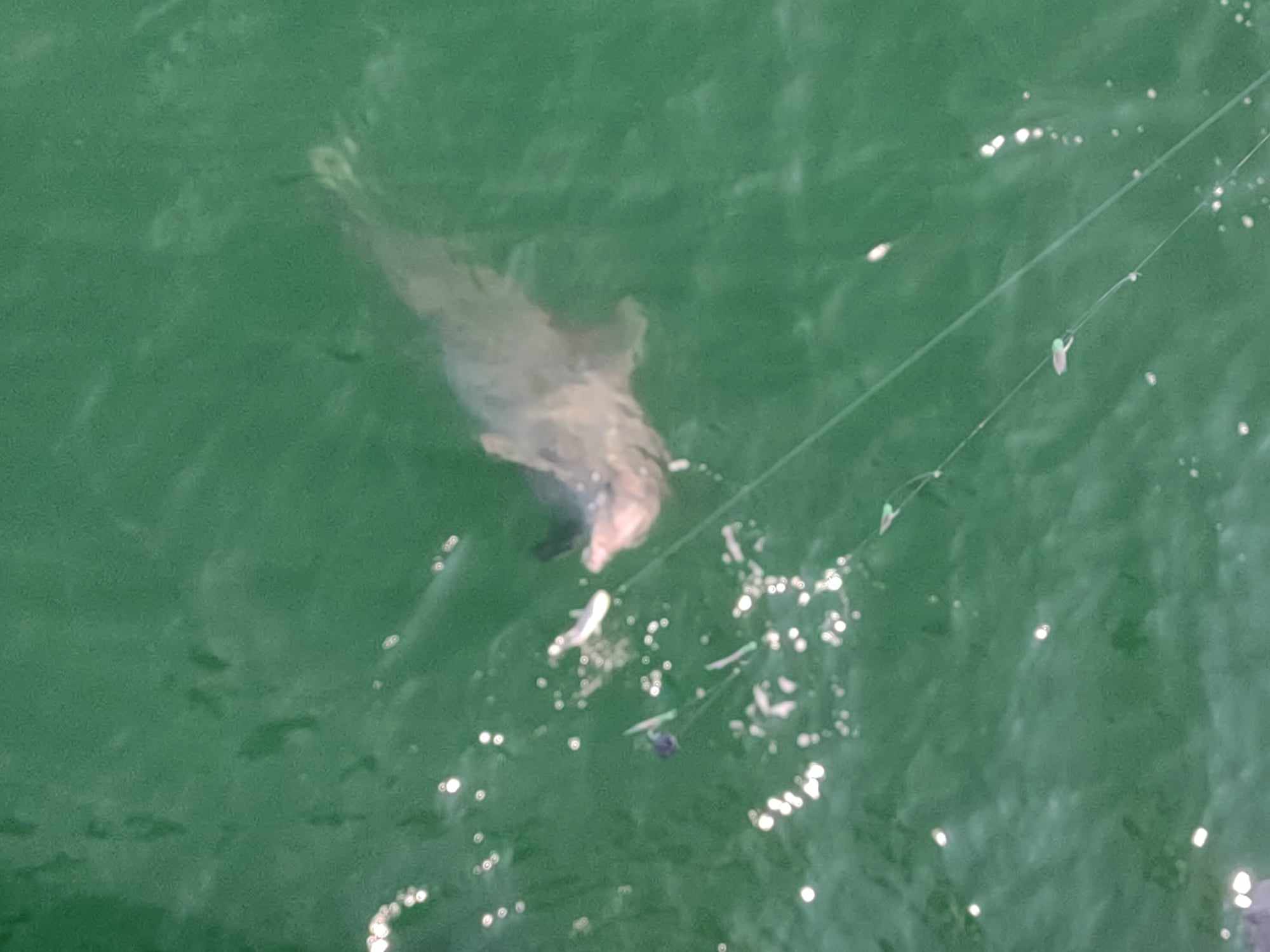
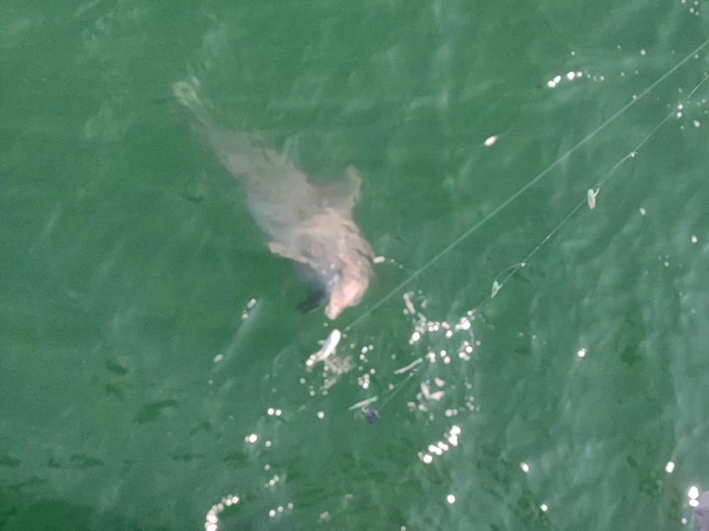
“Flipper, the tax man” made his presence known frequently. If he was not patrolling the perimeter of the pier, he was trying to take our fish. We had one, in particular, that would sit up in the water and beg for you to drop a fish. Here he is trying to take this angler’s Ladyfish:
Daily activity:
Thursday: water temp 86.4 – 88.2 A few small Spanish caught on Sabiki rigs, Hardtails, Yellowtail Jack and a few Ladyfish.
Friday: water temp 86.7 – 87.6 One Bonita early am, Yellowtail Jacks, Hardtails and a few small Spanish, a few Cigar minnows.
Saturday: water temp 86.2 - 87.4
Sunday: water temp 85.0 – 87.6 A few Spanish and Bonita in the am.
Monday: water temp 86.0 – 88.2 Hardtails, undersize Pompano, and a few Ladyfish.
Tuesday: water temp 85.4 – 87.6 Hardtails, a few Spanish Mackerel and two undersize Kings.
Wednesday: water temp 86.2 – 87.6 Hardtails and a few Spanish Mackerel and Ladyfish.
Red Tide status: According to the Florida Fish and Wildlife Conservation Commission (FWC), the red tide organism, Karenia brevis, was not observed in samples collected statewide over the past week 1. The FWC continues to use satellite imagery from the University of South Florida and NOAA National Centers for Coastal Ocean Science to track nearshore and offshore conditions.
Tides Link
https://tides4fishing.com/us/florida-west-coast/panama-cityngin g
New Moon Thursday Sept. 14, 2023 Full Moon Friday Sept. 29, 2023
Tides for the upcoming week:
Sunrise: 6:26am Sunset: 6:49pm
Thursday 14th. 6:20pm Low 0.8 11:02am High 1.5
Friday 4:31am Low 0:9 12:25am High 1.2
6:13pm Low 1.0 12:02pm High 1.4
Saturday 5:55am Low 0.9 12:15am High 1.2
5:39pm Low 1.1 1:10pm High 1.3
11:44pm High 1.3
Sunday 7:13am Low 0.8 2:30pm High 1.1
4:50pm Low 1.1 11:38pm High 1.5
Monday 8:35am Low 0.7
Tuesday 10:03am Low 0.6 12:02am High 1.7
Wednesday 20th. 11:38am Low 0.5 12:38am High 1.8
Sunrise: 6:29am Sunset: 6:42pm CDST
The Marine forecast for the next several days is:
THURSDAY
North winds 5 to 10 knots, becoming northwest in the afternoon. Waves 1 foot or less. Protected waters a light chop. A chance of showers and thunderstorms.
THURSDAY NIGHT
Northwest winds 5 to 10 knots, becoming northeast after midnight. Waves 1 foot or less. Protected waters a light chop. A chance of showers and thunderstorms.
FRIDAY
Northeast winds 5 to 10 knots. Waves 1 foot or less. Protected waters a light chop. Showers and thunderstorms likely.
FRIDAY NIGHT
Northeast winds 5 to 10 knots, becoming east after midnight. Waves 1 foot or less, then around 2 feet with a dominant period of 3 seconds after midnight. Protected waters a light chop. Showers and thunderstorms likely.
SATURDAY
East winds 5 to 10 knots. Seas around 2 feet with a dominant period of 3 seconds in the morning, then 1 foot or less. Protected waters a light chop. Showers and thunderstorms likely, mainly in the morning.
SATURDAY NIGHT
Southeast winds 5 to 10 knots. Waves 1 foot or less. Protected waters a light chop. A chance of showers and thunderstorms in the evening, then showers and thunderstorms likely after midnight.
SUNDAY
East winds 5 to 10 knots, becoming northwest in the afternoon. Waves 1 foot or less. Protected waters a light chop. Showers and thunderstorms likely.
SUNDAY NIGHT
North winds 5 to 10 knots. Waves 1 foot or less. Protected waters a light chop. Showers and thunderstorms likely.
(local forecast).
THURSDAY (87/75 rain 24% wind NW-08)
FRIDAY (86/74 rain 49% wind N-07)
SATURDAY (85/74 rain 54% wind SE-08)
SUNDAY (84/72 rain 46% wind NW-08)
MONDAY (86/72 rain 16% wind NE-08)
TUESDAY (87/72 rain 18% wind E-09)
WEDNESDAY(86/72 rain 24% wind E-10)
PIER MANAGEMENT CONTACT INFORMATION:
Bay County Parks and Recreation – 5304 Majetti Tower Road Panama City, FL 32404
850-248-8730
Vince Martin – Bay Co. Parks Division Manager - vmartin@baycountyfl.gov - 850-896-6580
Tight lines and screaming drags,
Sam