The water has been cold and stained. The water temperature was below 60 degrees, 6 of the 7 days. The pier was a little crowded at times as Christmas and New Year brought a big increase of anglers and spectators to town.
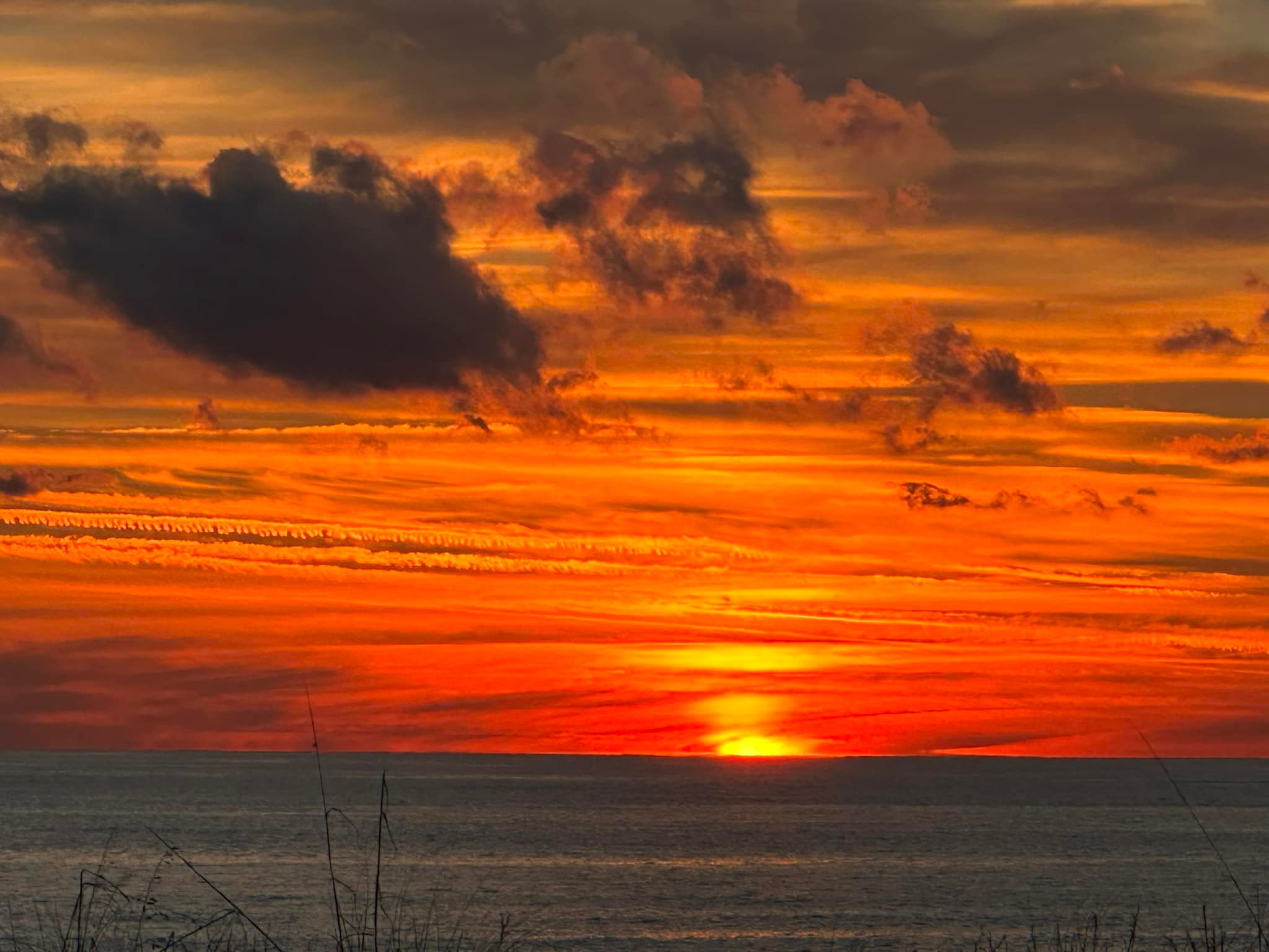
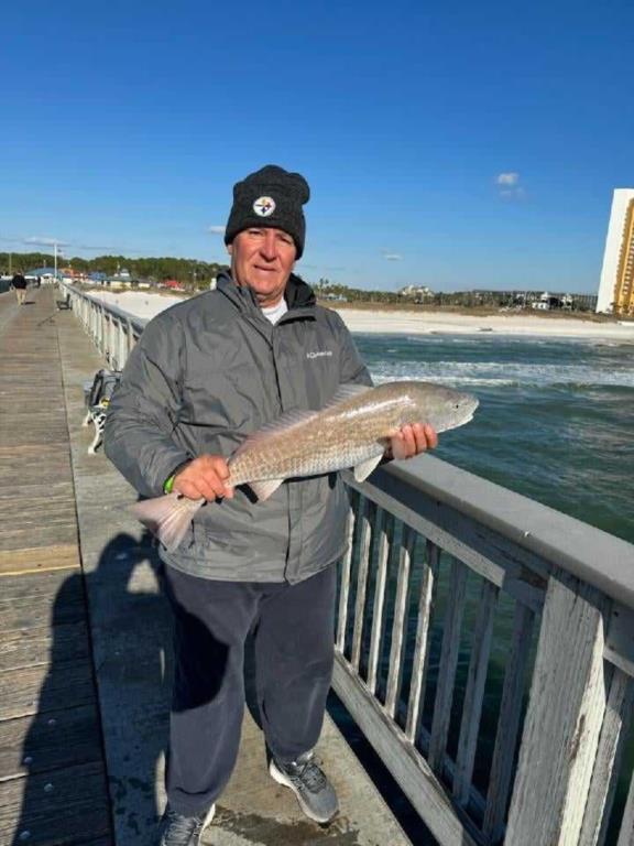
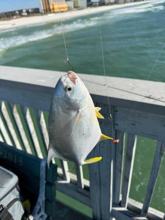
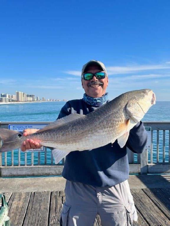
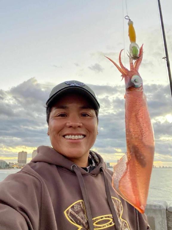
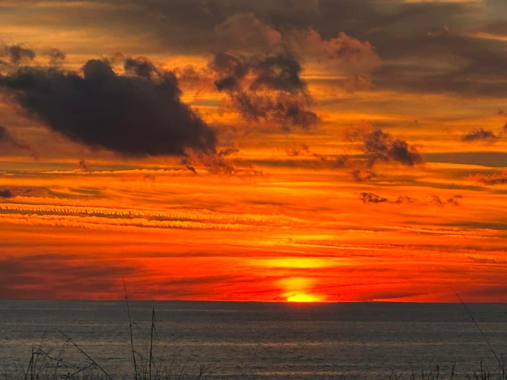
The bite was slow, so patience was the name of the game. There were Whiting each day with a few Red Drum in the mix. A few Pompano made their presence known as well. Squid were also caught but nothing consistent. Jack was one of the few that braved the cold wind on 12/29 but it paid off. He decked 8 Whiting, 2 Red Drum (one slot) and a couple of Pompano. George finished the year with a Bull Red on 12/31. Brenda got a couple of Kraken size Squid and mother nature closed the year with a spectacular sunset.
Daily activity:
Thursday: water temp 60.1 – 61.5 A few Whiting, a Pompano
Friday: water temp 57.7 – 58.5 Cold wind! Red Drum, Whiting and a couple of Pompano
Saturday: water temp 57.2 – 58.6 Whiting and a Red Drum
Sunday: water temp 56.7 – 59.7 Red Drum, Whiting
Monday: water temp 59.2 – 58.6 – 60.4 Happy New Year! Whiting
Tuesday: water temp 58.8 – 59.9 One Flounder and a few Whiting
Wednesday: water temp 59.2 – 57.9 – 59.2
Red Tide status: The red tide organism, Karenia brevis, was not observed in samples collected statewide over the past week.
Tides Link
https://tides4fishing.com/us/florida-west-coast/panama-cityngin g
New Moon Thursday Jan. 11, 2024 Full Moon Thursday Jan. 25, 2024
Tides for the upcoming week:
Sunrise: 6:39am Sunset: 4:55pm
Thursday 04th. 7:17am Low 0:0 4:40pm High 0.7
Friday 4:05am Low -0.2 4:39pm High 0.9
Saturday 4:17am Low -0.4 5:07pm High 1.0
Sunday 4:47am Low -0.6 5:50pm High 1.2
Monday 5:27am Low -0.8 6:40pm High 1.3
Tuesday 6:13am Low -0.9 7:33pm High 1.5
Wednesday 10th. 7:02am Low -1.0 8:29pm High 1.5
Sunrise: 6:39am Sunset: 5:00pm CST
The Marine forecast for the next several days is:
THURSDAY
North winds 15 to 20 knots, diminishing to 10 to 15 knots in the afternoon. Seas 3 to 5 feet with a dominant period of 7 seconds. Protected waters choppy.
THURSDAY NIGHT
Northeast winds 10 to 15 knots, becoming east 15 to 20 knots after midnight. Seas 3 to 4 feet with a dominant period of 7 seconds. Protected waters choppy.
FRIDAY
East winds 15 to 20 knots, becoming southeast 20 to 25 knots in the afternoon. Seas 4 to 6 feet with a dominant period of 5 seconds. Protected waters rough. A slight chance of showers and thunderstorms in the afternoon.
FRIDAY NIGHT
Southeast winds 25 to 30 knots, becoming south after midnight. Seas 5 to 7 feet with a dominant period of 7 seconds, building to 7 to 10 feet with a dominant period of 7 seconds after midnight. Protected waters very rough. Showers. A slight chance of thunderstorms in the evening, then a chance of thunderstorms after midnight.
SATURDAY
West winds 20 to 25 knots with gusts up to 30 knots, diminishing to 15 to 20 knots in the afternoon. Seas 6 to 9 feet with a dominant period of 8 seconds. Protected waters rough. Showers with a chance of thunderstorms in the morning, then a chance of showers in the afternoon.
SATURDAY NIGHT
Northwest winds 10 to 15 knots. Seas 4 to 6 feet with a dominant period of 7 seconds. Protected waters a moderate chop.
SUNDAY
North winds 10 to 15 knots. Seas 3 to 4 feet with a dominant period of 7 seconds. Protected waters a moderate chop.
SUNDAY NIGHT
Northeast winds 10 to 15 knots, becoming east 15 to 20 knots after midnight. Seas 3 to 4 feet with a dominant period of 7 seconds. Protected waters choppy.
MONDAY
East winds 20 to 25 knots, increasing to 25 to 30 knots in the afternoon. Seas 5 to 7 feet with a dominant period of 4 seconds. Protected waters very rough. A slight chance of thunderstorms. A chance of showers in the morning, then showers in the afternoon.
MONDAY NIGHT
Southeast winds 25 to 30 knots. Seas 7 to 10 feet, building to 9 to 12 feet after midnight. Protected waters very rough. Showers, thunderstorms.
(local forecast). The weather forecasters predict several inches of rain and some high winds over the next several days.
THURSDAY (60/42 rain 06% wind N-10)
FRIDAY (64/59 rain 24% wind ESE-14)
SATURDAY (64/48 rain 12% wind W-15)
SUNDAY (61/47 rain 06% wind NNW-08)
MONDAY (59/57 rain 85% wind E-18)
TUESDAY (66/43 rain 78% wind SW-27)
WEDNESDAY(54/46 rain 03% wind WNW-11)
PIER MANAGEMENT CONTACT INFORMATION:
Bay County Parks and Recreation – 5304 Majetti Tower Road Panama City, FL 32404
850-248-8730
Vince Martin – Bay Co. Parks Division Manager - vmartin@baycountyfl.gov - 850-896-6580
Tight lines and screaming drags,
Sam